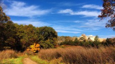


NORTH 40
Visit FRIENDSOFTHENORTH40.ORG to learn more.
FOR IMMEDIATE RELEASE
Town of Wellesley and Wellesley College Announce Completion of North 40 Sale
The Town of Wellesley Takes Ownership of the Parcel Known as The North 40; Wellesley College Will Participate in Planning for the Property
WELLESLEY, Mass. (June 8, 2015) –Wellesley College and the Town of Wellesley today announced that the sale of the parcel of land known as the North 40 has been completed. Now that the Town owns this important community resource, it will begin the process of determining its future use with participation from the College.
Read the entire Press Release.
March 3, 2015: Wellesley voters overwhelming approve purchase of the North 40!
The North 40 shares the following attributes of the Brookside/Longfellow Pond/Town Forest area:
- Located over an aquifer
- Part of a Zone II Water Supply Protection District
- Valuable ecosystem (which includes a vernal pool)
- Large wildlife corridor (contiguous to Morses Pond)
- Part of our Town's valued trails system
- Hosts community gardens
- Provides passive recreation to residents
- Enjoyed by the public for decades.
Like our own beloved neighborhood conservation lands, this 46-acre natural resource benefits our entire town. We feel the fate of this land so closely aligns with our Friends of Brookside mission, we urge you to make it to the polls on March 3rd and vote, "Yes."
Petition To Wellesley College
Open Letter to Wellesley College President H. Kim Bottomly and the Board of Trustees
Open Letter to WC.pdf
Adobe Acrobat document [117.6 KB]
Sustainability
Water Considerations
Mass DEP Water Supply Protection Area
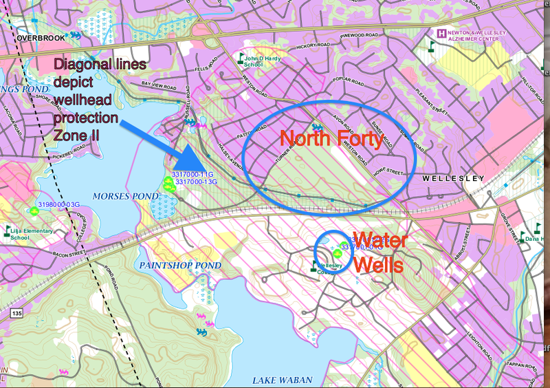 MassDEP Water Supply Protection Areas Map. Water wells are indicated as green dots in the center of the map.
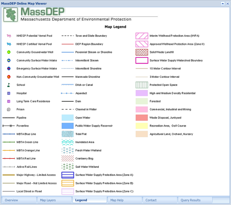 Mass DEP Legend
SWAP Report
2003 MassDEP Source Water Assessment and Protection (SWAP) Report*
*This one-time assesment report is from 2003. Many recommendations have been implemented. Much of the information is still relevant.
Wellesley Groundwater Resources Map
The yellow circle below shows the approximate area of the North 40. The red circle indicates the location of Wellesley College drinking water wells. The grey areas portray the aquifer, and the pink overlay area is the Wellhead Protection Area.
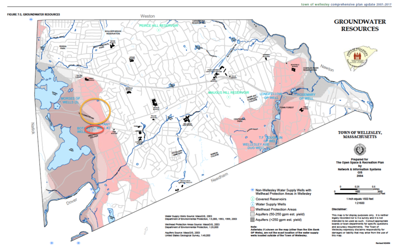 Wellesley Groundwater Resources Map
See our Wellhead Protection Page for more information.
Lighting Considerations
Wellesley College Whitin Observatory
About the Observatory:
The Whitin Observatory Construction Project
Blinded by the Lights - Boston Globe Article on Whitin Observatory
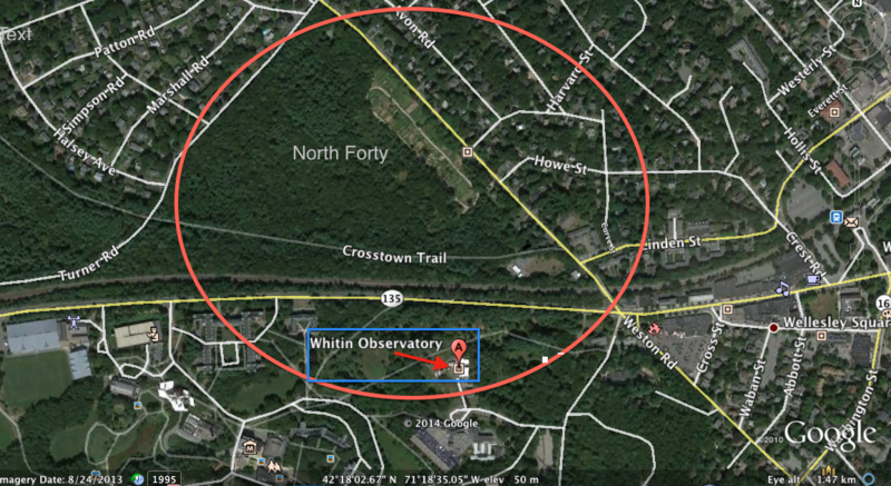
Location of the Whitin Observatory
 Wellesley College Whitin Observatory